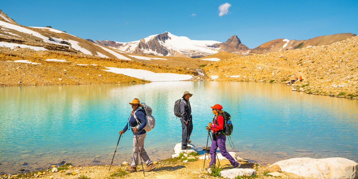
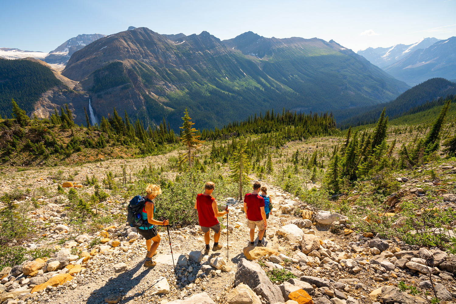
The Iceline Trail in Yoho National Park is hands down one of the top day hikes in the Canadian Rockies and is also one of my favourite hikes for photography. It has it all when it comes to photographing the mountain environment; raging rivers, countless waterfalls, jagged mountains, numerous hanging glaciers, two distant icefields, secluded alpine lakes & a taste of British Columbia’s sub-alpine forest which is spread out in a way so as to keep stringing you along on this classic loop hike.
Trail description
The water in the Yoho Valley is renowned for it’s power and along the Iceline Trail you will get many opportunities to photograph it especially on a telephoto lens. Takkakaw Falls (the second highest in Canada at over 300m high), will be visible for a large chunk of the day and offers great potential for self generated rainbows off its spray in late afternoon lighting. Laughing Falls is also on the loop and If you go clockwise on the trail you can cool off in it’s spray on a warmer afternoon after completing most of your hike by the time you get to it. Point Lace Falls and the Angel’s Staircase are also quick side trips off the main trail that are quieter while waterfalls generated from the hanging glaciers along the alpine section of the route are a sight to see. As the day heats up, and especially in July when snow melt is also a contributor, water volumes increase really showcasing the power of the valley.


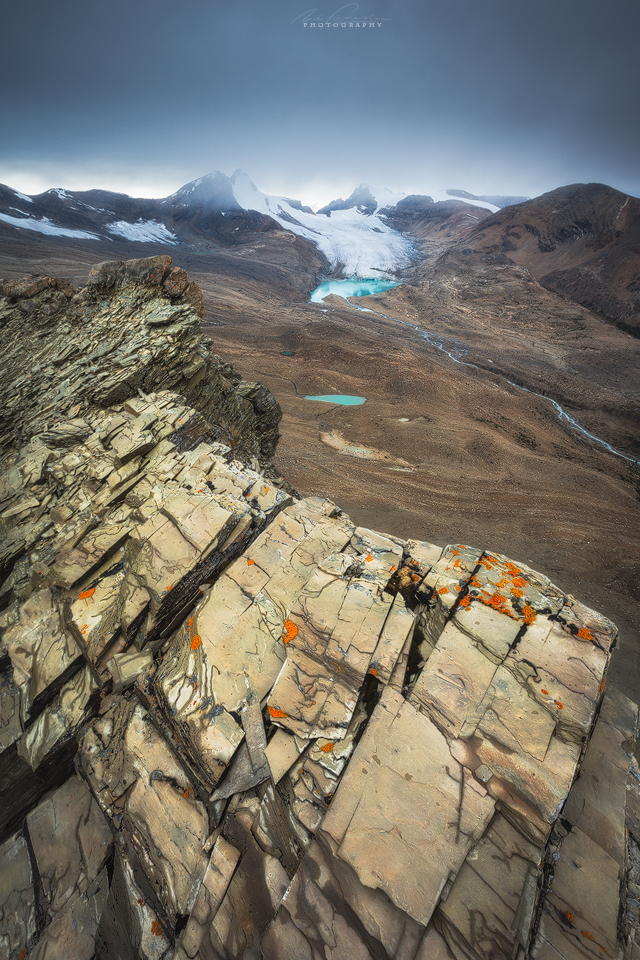
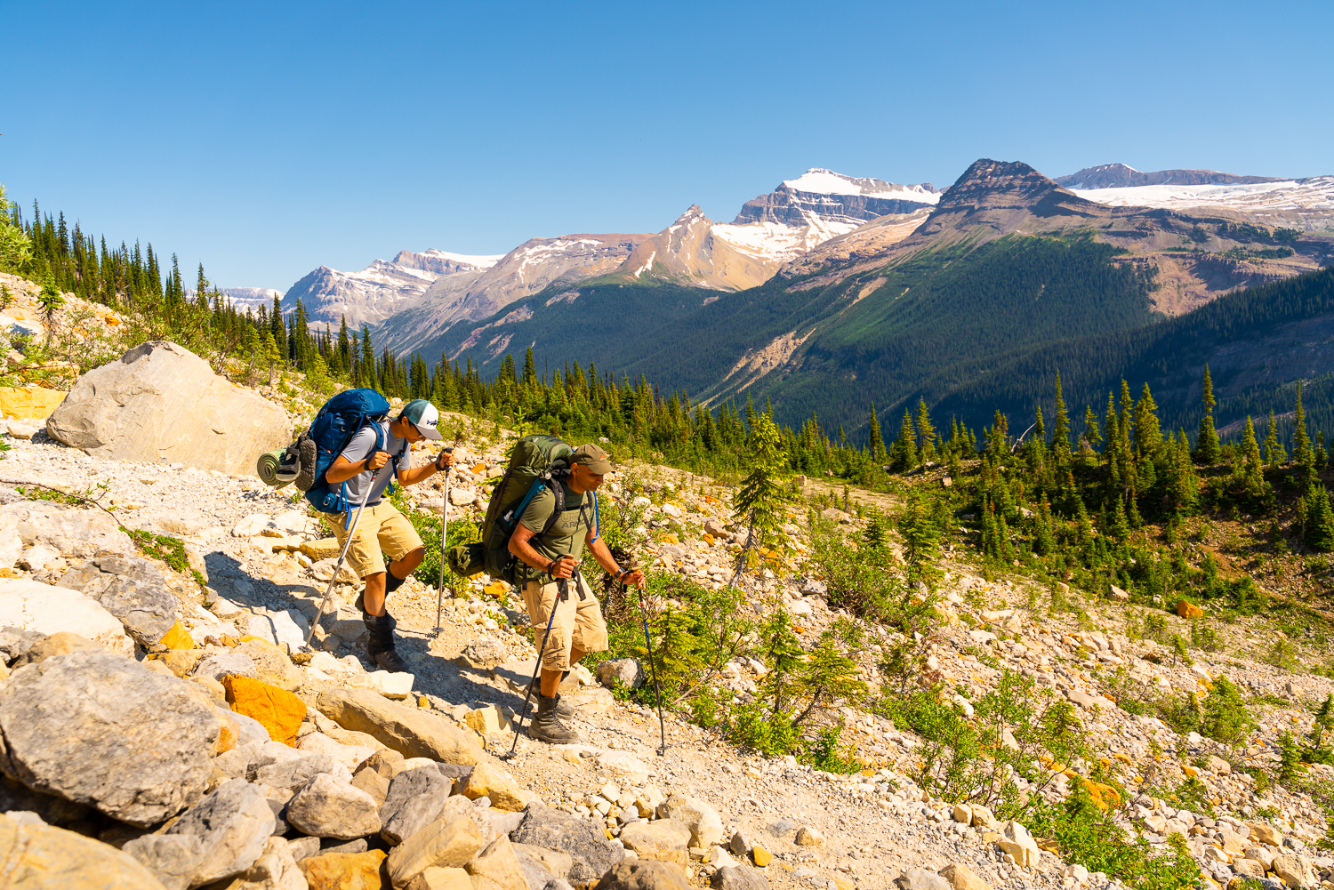
The views from the Iceline Trail are vast and uninterrupted. There’s a 360 degree vista for a significant portion of the hike so frequent stopping is necessary so you don’t trip over on an inconveniently naturally placed rock on the trail! The views are punctuated by the glaciers which hang onto the face of the Vice President & Michael Peak very close to the trail itself, as well as by distant glaciers across the valley fed by the Waputik Icefield. These include the Daly Glacier, the Fairy Glacier, the Diableret Glacier, and the Niles Glacier. The Yoho Glacier at the head of the valley is also prominent in the distance, fed by the Wapta Icefield. I would highly recommend carrying a lightweight telephoto lens to capture all of this. In mid summer, seeing the glaciers defined without any remaining snow pack is special as many of these will not exist for much longer. People who return year after year have seen drastic changes in the ice as it recedes and the Iceline Trail offers one of the best places to safely see so many glaciers at once while they are still with us.
Turquoise and emerald alpine lakes lie in waiting at various points throughout the upper sections of the trail. These include official lakes; Yoho Lake, Celeste Lake, Duchesnay Lake and Hidden Lakes and many photogenic unofficial lakes especially near the Iceline Summit and the high points along the Iceline Trail. Don’t be fooled they are extremely cold to swim in as the runoff is coming from glaciers and snow above but on a hot summers day it’s inevitable that somebody takes a scream filled dip! Bring your mosquito repellent for around the forested waterways especially in June-July although the higher alpine sections of the trail are usually quite bug free.


I’m not going to give it all away with blow by blow trail descriptions because it’s nice to partly discover a place for yourself or with a professional hiking guide but there are some logistical details below on how to get there, what route options there are for the hiking, and if you are interested in a guided photography focused hike along the Iceline trail, some details on how to sign up to join me on an adventure. Hopefully this brief overview of what to expect when hiking the Iceline Trail in Yoho National Park gets you fired up for summer hiking and photography in the Canadian Rockies!

Getting there
The Iceline Trail is only accessible from mid June to early October, so less than 4 months of the year (although people do ski up there in the winter time as the area has Alpine Club of Canada huts to use – the Stanley Mitchell Hut and the Louise & Richard Guy Hut being the closest ones to the Iceline Trail). The 13.7km Yoho Valley Rd is closed in the off season due to avalanche paths crossing the road. The best places to stay prior to visiting the Iceline Trail would be in the towns of Lake Louise, Field or Golden. If front country camping the Kicking Horse campground (reservable) or Monarch campgrounds (first come first served) are at the bottom of the Yoho Valley Road or if you want a site with the sound of a roaring Takkakaw Falls to put you to sleep, the 500m walk in ‘backcountry’ campground right near the trailhead for the Iceline Trail is a great choice. Alternatively there is a HI Hostel – Whiskey Jack also at the trailhead.
Iceline Trail Information & Map
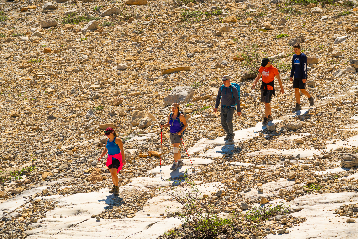
There are many choices when completing the Iceline Trail. Two common choices are to complete the loop via Celeste Lake which is slightly shorter (17km / ~800m elevation gain) or via Little Yoho Valley/Stanley Mitchell Hut (20km / ~900m elevation gain). You can also do an out-and-back style to shorten the length slightly turning around near the Iceline Summit. Adding on a visit to Yoho Lake (+ 3km) just off the Iceline Trail is also highly recommended if you have the energy and time. It is not pictured on the map being just off the bottom. Make sure to buy the ‘Lake Louise + Yoho’ Gem Trek Topographic Map for the region here before heading out.
Then there is the consideration for completing the loop clockwise or anti-clockwise. The clockwise direction means the steeper section is early and uphill, with a more gradual descent later on. Photographically both directions will work for different reasons due to lighting angles along the trail at certain times of day.
Check current trail conditions here – https://www.pc.gc.ca/en/pn-np/bc/yoho/activ/randonnee-hike/etat-sentiers-trail-conditions
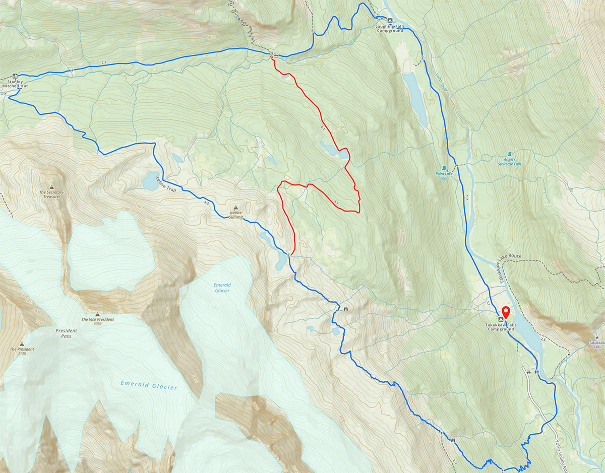
shorter version via Celeste Lake (substitutes the red section in instead of the longer loop).
Hiking extensions near the Iceline Trail
There are so many possibilities for extending your hiking here but most of them will require an overnight stay in the Stanley Mitchell Hut or at a backcountry campground (Little Yoho, Yoho Lake, Twin Falls, & Laughing Falls are all options for backcountry camping on or near to the Iceline Trail). Book a spot in January on the day the trail system opens to avoid disappointment. They are popular! My favourite extensions include Kiwetinok Lake, the Whaleback Summit & Twin Falls/Waterfall Valley.
Book a guided hike on the Iceline Trail
We offer guided day hikes with photography learning incorporated into the day on the Iceline Trail. More information can be found on our ‘Hike + Photo Adventure Page’ here: https://www.mountainphototours.ca/hiking-photo-adventures/
These are led by a licensed, insured, professional hiking guide who will have your comfort and safety as the top priority. Use the contact form below for more information on the experience.
Contact us here to request more information about our Iceline Trail guided hike or about other guided hiking possibilities in the Canadian Rockies and elsewhere in Canada.
Sign up to our mailing list below to receive information about new guided hikes or photo tours as they become available.